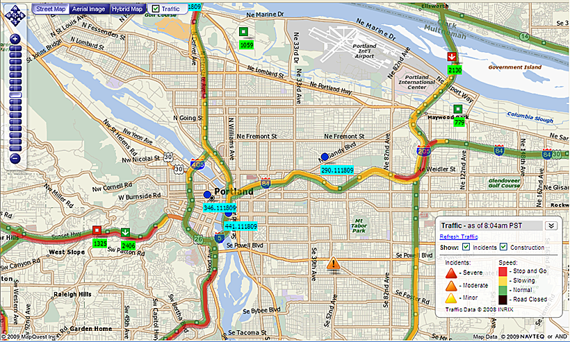
Looking at the lower left of the picture, you can see driver 2406 on the Sunset Highway near West Slope.
This driver has a hot shipment on board for a hi tech company that needs to catch a flight at Portland International. From the driver’s current position, normally the fastest route would be to take State Route 26, to I-5; then head for the airport via I-84 and I-205.
However, as you can see from the GPS and the map link; traffic is slowing on I-84, and is at a standstill near the junction with I-205. Chances are that the driver would miss the flight.
Thanks to GPS and the map link, we were able to reroute the driver to I-405, then I-5 towards Columbia and then pick up 82nd street towards the airport.
Without this capability, it would have been difficult to reroute the driver in enough time for the shipment to make the flight.